Severe Thunderstorm Warning Issued for Enoch Mgijima
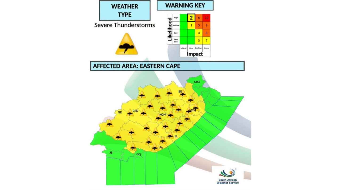
Residents across the Enoch Mgijima Local Municipality have been placed on high alert after the South African Weather Service (SAWS) issued an Orange Level 5 warning for severe thunderstorms expected on Monday, 23 February 2026.
The warning is valid from 05:00 until 21:59 and highlights the risk of significant weather impacts across several municipalities in the Eastern Cape, including Dr Beyers Naudé, Blue Crane Route, Raymond Mhlaba, Amahlathi, Inxuba Yethemba, Enoch Mgijima, Emalahleni, Walter Sisulu and Senqu.
For Komani and surrounding areas, the focus is firmly on the potential for localised flooding and storm-related damage.
What the Warning Means for Komani
An Orange Level 5 warning indicates a high likelihood of severe thunderstorms that may lead to:
-
Localised flooding of roads, low-lying bridges and settlements
-
Damage to informal and formal housing structures
-
Damage to vehicles
-
Possible impact on municipal infrastructure
Residents in Komani, Ezibeleni, Mlungisi, Madeira Park, Komani Park and surrounding rural areas are urged to prepare for heavy downpours, strong winds, and possible lightning.
Stormwater systems in parts of Komani have previously struggled during intense rainfall events. If rainfall is sustained over several hours, surface flooding could disrupt traffic and access routes.
Potential Impact on Services
Heavy rainfall may lead to:
-
Road closures or dangerous driving conditions
-
Temporary electricity disruptions if infrastructure is affected
-
Delays in emergency response times
-
Strain on already vulnerable municipal infrastructure
Motorists are advised to avoid driving through flooded roads, as water depth can be misleading. Even shallow water can cause vehicles to stall or lose control.
Residents living near streams, drainage lines or low-lying areas should remain particularly cautious.
Safety Precautions
Authorities advise the following precautions during severe thunderstorms:
-
Avoid sheltering under trees during lightning
-
Secure loose outdoor items that could be blown away
-
Keep mobile devices charged in case of power interruptions
-
Avoid crossing flooded bridges or roads
-
Stay indoors during intense lightning activity
Community members are also encouraged to monitor official weather updates and emergency communications throughout the day.
Broader Eastern Cape Alert
While Komani remains a key focus, the warning extends across multiple local municipalities in the province. Severe thunderstorms may vary in intensity from one area to another, but all affected regions are expected to experience potentially disruptive conditions.
The South African Weather Service continues to monitor the situation and may issue further updates should conditions intensify.
Residents are urged to take the warning seriously and remain weather-aware throughout Monday.
Komani News will continue to monitor developments and provide updates as new information becomes available.
Follow Komani News on WhatsApp for live updates:
https://whatsapp.com/channel/0029VbBhEqB0gcfT9q6gck1r